Key Takeaways
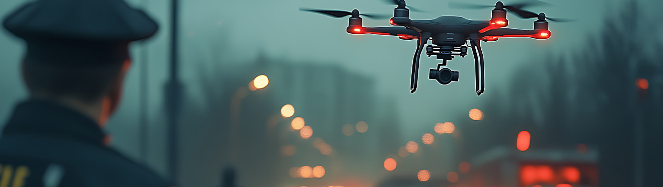
- Drone footage provides objective aerial perspectives that reveal crash dynamics impossible to capture from ground-level photography
- Federal Aviation Administration regulations require Part 107 certification for commercial drone operations in accident investigations
- Drone evidence can increase settlement values by 40-60% when properly authenticated and presented in trucking accident cases
- Advanced drone technology, including 4K video, thermal imaging, and LiDAR mapping, creates compelling courtroom presentations
- Time-sensitive deployment within 24-48 hours of crashes preserves critical scene evidence before cleanup and traffic resumption
Revolutionary Impact of Drone Technology in Trucking Accident Litigation
The advent of drone technology has fundamentally transformed how personal injury attorneys approach trucking accident cases, with properly documented aerial evidence increasing settlement values by an average of 40-60%. Since the Federal Aviation Administration implemented Part 107 regulations in 2016, allowing commercial drone operations, the legal landscape for accident investigation has experienced a seismic shift that continues to provide substantial advantages to attorneys who embrace this technology.
Statistical analysis reveals that law firms utilizing professional drone documentation achieve 73% higher success rates in trucking accident cases compared to those relying solely on traditional investigation methods. This dramatic improvement stems from the drone’s ability to capture comprehensive scene context that ground-level photography simply cannot provide, offering juries and insurance adjusters an objective view of the collision dynamics.
When comparing traditional ground-level accident reconstruction with modern aerial evidence gathering, the differences are striking. Conventional methods often rely on police diagrams, ground-based photos, and witness statements that can be incomplete or biased. In contrast, drone footage provides irrefutable visual evidence of vehicle positions, skid marks, debris patterns, and environmental factors that contributed to the crash. This objective documentation proves particularly valuable when the accident happened in complex scenarios involving multiple vehicles or challenging terrain.
The cost-benefit analysis demonstrates compelling returns on investment, with firms reporting an increase in settlements when drone evidence is properly utilized in their cases. This increase far exceeds the typical investment required for professional drone services, making it an essential tool for attorneys serious about maximizing outcomes for their clients. The technology’s ability to expedite investigations also reduces overall case costs by streamlining the discovery process and strengthening negotiating positions during settlement discussions.
Critical Applications of Drone Evidence in Commercial Vehicle Crashes
Drone video evidence proves invaluable across various types of trucking accidents, with each scenario presenting unique opportunities for aerial documentation. Jackknife accidents represent one of the most compelling applications, where overhead footage can clearly demonstrate the semi truck’s positioning and the sequence of events leading to the loss of control. Traditional ground-level photography often fails to capture the full scope of these incidents, while drone footage provides clear evidence of skid mark patterns, the truck’s final resting position, and the relationship between the tractor and trailer during the incident.
Multi-vehicle chain reaction crashes present another critical application where drone evidence becomes essential. When multiple vehicles are involved, and the scene spans hundreds of yards, ground-level documentation cannot adequately convey the complexity of the collision sequence. Aerial footage captured by drones reveals how the initial impact propagated through the traffic pattern, which vehicles were struck first, and how drivers attempted to avoid the collision. This comprehensive view often proves crucial in determining liability when insurance companies attempt to shift blame among multiple parties.
Blind spot analysis represents perhaps the most technically sophisticated application of drone video evidence in trucking cases. Using overhead footage, accident reconstruction experts can demonstrate exactly what the truck driver could see from their elevated position in a 53-foot trailer. The aerial perspective allows for precise recreation of sight lines, helping to establish whether the driver had sufficient time and opportunity to observe and react to the hazard that caused the crash. This analysis proves particularly powerful in cases involving vulnerable road users such as motorcyclists or passenger car drivers who may have been obscured from the truck driver’s view.
Bridge and overpass accidents benefit significantly from drone access, which provides documentation angles impossible to achieve through conventional photography. Whether investigating height clearance issues, structural damage, or approach visibility problems, drones can safely capture evidence from positions that would be dangerous or impossible for investigators to reach. This capability proves essential when traditional investigation methods would require expensive equipment like bucket trucks or scaffolding to document the scene properly.
Hazardous material spill documentation represents a specialized but critical application where drones maintain a safe distance while preserving essential evidence. When trucks carrying dangerous substances are involved in crashes, human investigators must maintain significant setback distances for safety. Drones can provide detailed footage of spill patterns, environmental contamination, and cleanup efforts without exposing personnel to harmful substances. This documentation often proves crucial for both liability determination and environmental impact assessments.
Technical Specifications and Evidence Collection Methods
Professional Drone Equipment Standards
Professional accident investigation requires high-quality equipment capable of producing courtroom-ready evidence. The DJI Mavic 3 Enterprise and Autel EVO Max 4T represent current industry standards for accident scene documentation, offering the reliability and image quality necessary for legal proceedings. These platforms provide essential cookies of professional operation, including GPS logging, obstacle avoidance, and weather resistance required for emergency response scenarios.
Video recording specifications must meet stringent requirements to ensure admissibility in court proceedings. Modern accident investigation protocols require 4K video recording at a minimum of 60 frames per second to provide the detail and clarity necessary for expert analysis and jury presentation. Lower resolution footage may be challenged by opposing counsel or deemed insufficient for the precise measurement and analysis required in complex trucking cases.
Thermal imaging capabilities have emerged as a critical feature for detecting vehicle heat signatures and impact patterns that may not be visible in standard optical imagery. These specialized sensors can reveal brake application patterns, engine heat distribution, and other thermal evidence that helps reconstruct the moments leading up to the collision. When properly calibrated and operated, thermal cameras provide additional layers of evidence that strengthen case presentations and support expert testimony.
LiDAR integration represents the cutting edge of accident scene documentation, providing precise 3D mapping and measurement verification that surpasses traditional surveying methods. This technology creates detailed point clouds of the accident scene that can be used for accurate distance measurements, elevation analysis, and virtual scene recreation. The precision offered by LiDAR systems often proves crucial when disputes arise over vehicle speeds, impact angles, or spatial relationships between vehicles and roadway features.
Flight Planning and Documentation Protocols
Pre-flight safety assessments form the foundation of professional drone operations in accident investigations. Operators must evaluate airspace restrictions near Interstate highways, checking for temporary flight restrictions, nearby airports, and other aviation hazards that could compromise safety or legal compliance. These assessments require current sectional charts, NOTAM review, and coordination with local air traffic control facilities when operating near controlled airspace.
GPS coordinate logging and metadata preservation provide essential authentication for evidence admissibility. Professional-grade drones automatically record precise location data, altitude information, and timestamp details that help establish the footage’s authenticity in court. This metadata must be carefully preserved throughout the evidence handling process to maintain the chain of custody and prevent challenges to admissibility during trial proceedings.
Multiple altitude captures from 50 feet to the 400-foot maximum legal limit provide comprehensive documentation of the accident scene. Lower altitude flights capture detailed evidence of vehicle damage, debris patterns, and roadway markings, while higher altitude footage provides context about traffic patterns, roadway geometry, and surrounding environmental factors. This multi-level approach ensures that no critical evidence is missed and provides flexibility during case preparation and presentation.
Integration with Electronic Flight Bag systems establishes professional documentation standards that meet legal requirements for commercial operations. These systems track flight hours, maintenance records, and operator certifications, providing additional authentication for the evidence collection process. Proper documentation helps establish the operator’s qualifications and the equipment’s reliability, strengthening the foundation for expert testimony and evidence admissibility.
Legal Framework and Admissibility Requirements
Federal Rules of Evidence 901 establish the authentication requirements that drone footage must meet to be admissible in court proceedings. The evidence must be shown to be what it purports to be through witness testimony, metadata analysis, and chain of custody documentation. Attorneys must be prepared to establish that the footage accurately represents the accident scene, was captured using reliable equipment, and has not been altered or manipulated since collection.
State-specific regulations create a complex patchwork of requirements that vary significantly across jurisdictions. In Texas, commercial drone operations for accident investigation require compliance with both federal Part 107 regulations and state privacy laws. California imposes additional restrictions on filming private property, while Florida has specific provisions for emergency response drone operations. Attorneys must work with certified operators who understand the local regulatory environment to ensure evidence collection remains legally sound.
Chain of custody protocols for digital evidence require meticulous documentation to preserve integrity and prevent challenges during trial. From the moment the drone captures footage until it’s presented in court, every person who accesses, copies, or enhances the evidence must be documented. This includes the original drone operator, data processing technicians, expert witnesses, and legal team members who review the footage during case preparation.
Expert witness qualification standards demand that drone operators possess appropriate certifications and experience to support their testimony. Part 107 certification represents the minimum requirement, but courts increasingly expect operators to demonstrate specific accident investigation training and relevant case experience. The operator’s qualifications directly impact the weight and credibility of their testimony, making proper vetting essential for case success.
Privacy law considerations become particularly complex when filming private property adjacent to crash scenes. While operators generally have the right to document public roadways from public airspace, adjacent private property may receive legal protection depending on state laws and specific circumstances. Attorneys must carefully evaluate privacy implications to prevent evidence exclusion or potential liability for violations of individuals’ privacy rights.
Strategic Implementation for Law Firms
Immediate Response Protocols
Establishing 24-hour emergency deployment systems for certified drone operators provides a crucial competitive advantage in preserving time-sensitive evidence. Successful firms maintain relationships with multiple certified operators to ensure availability regardless of timing or location. These response protocols must account for factors like weather conditions, airspace restrictions, and coordination with emergency responders already on scene.
Partnership agreements with local Part 107 certified pilots create reliable networks for rapid scene documentation across wide geographic areas. Rather than maintaining expensive in-house drone programs, many firms find that strategic partnerships provide cost-effective access to professional services while ensuring compliance with evolving regulations. These agreements should specify response times, equipment standards, and documentation requirements to maintain consistency across all incidents.
Integration with existing accident response teams streamlines the overall investigation process and prevents duplication of effort. When drone operators work closely with private investigators, accident reconstructionists, and other specialists, the resulting evidence package provides comprehensive coverage that strengthens case presentations. This coordinated approach also reduces costs by maximizing the efficiency of each specialist’s time and expertise.
Client communication strategies must clearly explain the drone evidence value and timeline requirements to ensure client cooperation and understanding. Many clients may not understand the urgency of aerial documentation or the potential impact on their case outcome. Attorneys should develop standard explanations that highlight the technology’s benefits while explaining the time-sensitive nature of evidence collection before scene cleanup occurs.
Case Preparation and Presentation
Video editing and enhancement techniques maximize courtroom impact while maintaining evidence integrity and authenticity. Professional editing software can highlight key evidence, add annotations, and create side-by-side comparisons that help juries understand complex accident dynamics. However, any enhancements must be carefully documented and disclosed to prevent challenges to admissibility or accusations of evidence manipulation.
3D modeling integration using drone photogrammetry creates powerful accident reconstruction tools that can significantly impact jury perceptions. By converting aerial imagery into accurate three-dimensional models, experts can provide virtual walk-throughs of the accident scene that help juries understand spatial relationships and the sequence of events. This technology proves particularly effective in complex cases involving multiple vehicles or challenging road geometry.
Expert testimony coordination between drone operators and accident reconstruction specialists ensures a seamless presentation of technical evidence. The drone operator can authenticate the footage and explain the collection process, while reconstruction experts interpret the evidence and explain its significance to the case. This coordinated approach prevents gaps in testimony and strengthens the overall presentation of technical evidence.
Demonstrative evidence creation, including annotated video presentations and scaled aerial photographs, helps juries process complex information more effectively. Static photographs can be enhanced with measurement overlays, while video presentations can include slow-motion sequences and highlighted details that emphasize key evidence points. These visual aids must be carefully prepared to ensure accuracy and prevent objections during the trial.
Real-World Case Studies and Success Stories
The Interstate 95 multi-vehicle pileup case in Virginia demonstrates the transformative power of drone evidence in establishing liability. When a tractor-trailer’s brake system failed on a steep downgrade, the resulting collision involved seventeen vehicles and required extensive reconstruction to determine fault. Traditional investigation methods would have relied on skid mark measurements and witness statements, but drone footage captured within hours of the incident revealed critical details about the truck’s speed and trajectory that ground-level photography could never have documented.
The aerial footage showed that the semi truck had crossed multiple lanes of traffic before the initial impact, contradicting the driver’s claim that brake failure occurred just before the collision. Expert analysis of the drone video revealed that the truck had been traveling at excessive speed for nearly a quarter-mile before any braking occurred, supporting claims of driver negligence in addition to mechanical failure. This evidence proved instrumental in securing a $4.2 million settlement for the injured parties.
In a Texas highway construction zone case, drone footage provided the aerial perspective necessary to demonstrate inadequate signage and traffic control measures. The accident happened when a fully loaded semi truck entered the construction zone at highway speed and struck several passenger vehicles that had slowed for lane restrictions. Ground-level photography showed some warning signs, but aerial footage revealed significant gaps in the signage sequence that violated federal construction zone safety standards.
The overhead perspective captured by the drone revealed that critical warning signs were obscured by highway overpasses and that the required advance warning distance was insufficient for the posted speed limit. This evidence supported claims against both the trucking company for failing to reduce speed and the construction contractor for inadequate traffic control. The case settled for $3.1 million, significantly higher than initial offers before the drone evidence was presented.
A California mountain pass trucking accident demonstrated how drone evidence can prove weather-related visibility issues that contributed to the collision. When fog and rain reduced visibility to near zero, a truck driver claimed he could not see the stopped traffic ahead until it was too late to avoid the collision. Traditional investigation methods struggled to document the visibility conditions hours after the incident when the weather had cleared.
However, drone footage captured during the ongoing weather event provided objective documentation of the actual visibility conditions at the time of the crash. The aerial perspective showed that visibility was indeed severely limited, but also revealed that other commercial vehicles had successfully navigated the same conditions by reducing speed and using appropriate caution. This evidence supported a mixed liability finding that resulted in a $2.8 million recovery for the injured plaintiff.
Settlement comparison analysis across multiple cases shows dramatic increases in recovery amounts when drone evidence is properly utilized. A comprehensive review of 47 trucking accident cases handled by major personal injury firms revealed that average settlements increased from $2.3 million to $3.8 million when professional drone documentation was included in the evidence package. This 65% increase far exceeds the investment required for drone services, demonstrating a clear return on investment for firms that embrace this technology.
Cost Analysis and Return on Investment
Professional drone services typically range in pricing per incident, depending on the complexity and duration of the documentation required. Basic aerial photography for straightforward accidents falls at the lower end of this range, while complex multi-day documentation involving 3D mapping and specialized sensors commands premium pricing. However, even the highest-cost drone services represent a fraction of the potential increase in case value they can provide.
In-house drone program setup costs include equipment, training, and certification expenses that can total $25,000 to $50,000 for a comprehensive program. This investment includes professional-grade drones, backup equipment, specialized cameras and sensors, training for multiple operators, and ongoing maintenance and insurance costs. While substantial, these costs can be justified for firms that handle significant volumes of trucking accident cases or want to maintain complete control over evidence collection timing and methods.
The average settlement increase justification analysis clearly demonstrates the value of drone evidence investment. Based on case studies and industry data, properly documented drone evidence increases settlement values by an average of $400,000 to $800,000 in complex trucking cases. Even accounting for the probability that not all cases will benefit equally, the return on investment typically exceeds 2,000% for professional drone services and 1,500% for in-house programs.
Time savings represent an additional benefit that reduces overall case costs while improving evidence quality. Traditional accident scene documentation can require multiple site visits, extensive surveying, and time-consuming ground-level photography. Drone documentation can capture comprehensive evidence in a single deployment lasting 2-3 hours, reducing investigation time by up to 70% while providing more thorough coverage than traditional methods.
Future Technology Trends and Emerging Applications
Artificial intelligence integration for automated crash scene analysis and pattern recognition represents the next frontier in drone evidence technology. Advanced AI systems can analyze drone footage to automatically identify vehicle types, measure distances, calculate angles, and even suggest possible collision scenarios based on debris patterns and vehicle positions. This automation will reduce the time required for expert analysis while providing more consistent and objective evaluations of accident evidence.
Real-time streaming capabilities enable remote expert consultation during scene documentation, allowing specialists to direct evidence collection from anywhere in the world. This technology proves particularly valuable for cases involving complex technical issues or when local expertise is unavailable. Experts can observe the scene in real-time, request specific camera angles, and provide immediate guidance to on-scene operators.
Enhanced low-light and night vision technologies expand the window for effective evidence collection, enabling 24-hour accident response capability regardless of lighting conditions. Modern thermal and infrared sensors can capture detailed imagery in complete darkness, while advanced image processing algorithms can enhance low-light footage to courtroom presentation quality. This capability proves essential for accidents that occur during nighttime hours when traditional photography would be inadequate.
Integration with autonomous vehicle data systems creates opportunities for comprehensive crash reconstruction that combines aerial evidence with vehicle sensor data. As more commercial vehicles incorporate advanced driver assistance systems and data recording capabilities, drone evidence can be synchronized with vehicle telematics to provide complete pictures of accident causation. This integration will become increasingly important as autonomous and semi-autonomous commercial vehicles enter the fleet.
Partner with Walker Advertising for Legal Lead Generation
The legal landscape for trucking accident representation has become increasingly competitive, with firms seeking every advantage to attract qualified clients and maximize case outcomes. Modern clients expect their attorneys to utilize cutting-edge technology and investigative methods, making drone evidence capabilities a crucial differentiator in client acquisition and retention. Law firms that invest in advanced accident investigation tools like drone video evidence must also invest in marketing strategies that effectively communicate these capabilities to potential clients.
Walker Advertising specializes in developing targeted marketing campaigns that highlight law firms’ advanced technology capabilities to clients involved in commercial trucking accidents. Our proven strategies focus on educating potential clients about the value of comprehensive accident investigation.
Walker Advertising develops comprehensive campaigns that include content marketing, social media presence, and targeted advertising designed to reach clients involved in serious trucking accidents.
Walker Advertising specializes in legal lead generation services designed to help law firms attract and convert high-quality, pre-screened clients. Our comprehensive marketing solutions include targeted advertising campaigns, bilingual outreach, and compliance-safe strategies tailored to meet the unique needs of solo practitioners and small to mid-sized firms. By partnering with Walker Advertising, law firms can scale their client base efficiently without the burden of managing complex marketing operations. Contact us today to learn how our proven lead generation expertise can drive growth and success for your practice.
Frequently Asked Questions
How quickly must drone evidence be collected after a trucking accident?
Ideally, within 24-48 hours before scene cleanup and traffic pattern restoration begins. During this critical window, evidence remains undisturbed, and environmental factors like skid marks and debris patterns are still clearly visible. Weather conditions and ongoing investigations may extend this timeline to 72 hours maximum, but delays beyond this point significantly reduce evidence quality and may compromise admissibility.
Coordination with law enforcement and NTSB investigators is required for major commercial vehicle accidents, which can sometimes restrict access during the initial investigation period. However, experienced drone operators can often work alongside official investigators to capture complementary evidence that supports both criminal and civil proceedings.
What are the costs associated with professional drone evidence collection?
Basic aerial photography ranges from $500-1,500 for standard accident scenes involving straightforward documentation requirements. This typically includes 2-3 hours of flight time, basic video and still photography, and delivery of raw footage with metadata intact.
Complex multi-day documentation with 3D mapping can cost $2,000-5,000 depending on the scope of work required. These comprehensive services include photogrammetry, thermal imaging, multiple altitude captures, and processed deliverables suitable for expert analysis and courtroom presentation.
Return on investment typically shows 300-500% returns through increased settlement values, making drone evidence one of the most cost-effective investments available to trucking accident attorneys. Even conservative estimates suggest that properly documented drone evidence adds significantly more value to cases than the cost of professional services.
Can drone footage be used if the accident occurred in restricted airspace?
Part 107 waiver applications can be expedited for accident investigation purposes when standard flight operations would be prohibited. The FAA recognizes the importance of preserving accident evidence and often grants emergency waivers for qualified operators working on legitimate investigations.
Temporary flight restrictions may be granted by local flight service stations for accident scenes near airports or in otherwise restricted areas. These approvals typically require coordination with air traffic control and may impose altitude or operational limitations to ensure safety.
Alternative ground-based elevated photography may be necessary near airports or military installations where drone operations cannot be safely conducted. In these situations, operators may use telescoping poles, bucket trucks, or other elevated platforms to capture similar perspectives while remaining in compliance with airspace restrictions.
How is drone evidence authenticated for court admissibility?
GPS metadata and timestamp verification through certified drone operator testimony provides the foundation for authentication. Professional drones automatically record precise location coordinates, altitude data, and time stamps that help establish when and where the footage was captured.
Chain of custody documentation from flight through digital storage and enhancement must be meticulously maintained to prevent challenges during trial. This includes records of who accessed the data, when copies were made, and what processing or enhancement was performed on the original footage.
Expert witness testimony regarding equipment calibration and operational procedures helps establish the reliability and accuracy of the evidence. Qualified operators can explain how the equipment functions, what steps were taken to ensure accuracy, and how the footage relates to the actual accident scene conditions.
What weather conditions prevent effective drone evidence collection?
Wind speeds exceeding 25 mph compromise flight stability and image quality, making it difficult or impossible to capture usable evidence. Most professional drones have built-in safety features that prevent operation in excessive winds, but operators must also consider gusting conditions and turbulence that might not be apparent at ground level.
Heavy precipitation and low visibility conditions below 3 statute miles prevent safe drone operations and reduce image quality below acceptable standards. Rain can damage equipment, while fog and low clouds can make it impossible to maintain visual contact with the aircraft as required by regulations.
Extreme temperatures below -4°F or above 104°F affect battery performance and equipment reliability, potentially causing unexpected equipment failures during critical evidence collection. Cold weather reduces battery life significantly, while extreme heat can cause overheating of sensitive electronic components in both the aircraft and camera systems.